This site uses affiliates. Thank you for buying through our links and supporting this blog.


10 Best Mount Cook Hikes & Walks: Aoraki Hiking Guide

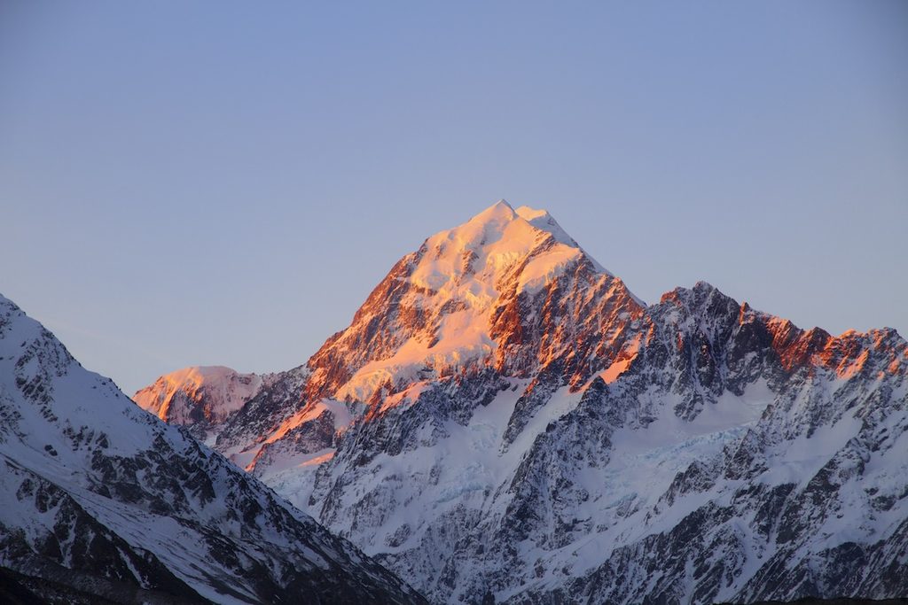
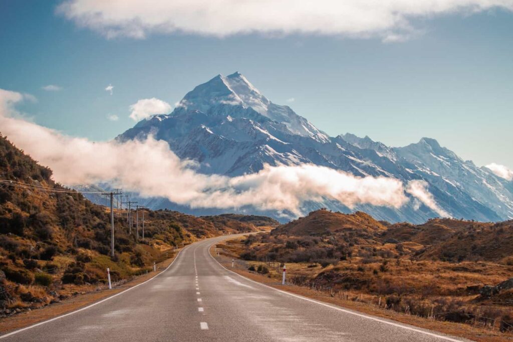
Aoraki/Mount Cook is New Zealand’s highest mountain at 3,724 m (12,218 ft), but you do not need to go anywhere near the summit to get some of the best alpine hiking in the country.
The national park is one of those places where choosing the wrong hike can waste a surprisingly good weather window: the valley can be clear at breakfast and swallowed by cloud or wind a couple of hours later, the most famous track is also the busiest, and several walks that look close together on a map actually start from different car parks.
I have spent a lot of time hiking around New Zealand, and Mount Cook is still one of the places that sticks with me most.
I loved the Hooker Valley Track enough to walk it twice in two days, went back early for quieter trails and better light, watched sunset from Kea Point, and still rate the Tasman Valley at sunrise as one of the easiest big-payoff stops in the park.
The good news is that you do not need to be a hardcore tramper to get ridiculous alpine views here. Some of the best Mount Cook walks take less than an hour. Others involve 2,200 stairs, 1,000 m (3,281 ft) of climbing and enough scree to make you question your life choices.

In a hurry?
Book your Mount Cook essentials!
Book accommodation first. There are very few places to stay inside Aoraki/Mount Cook Village, and sleeping here gives you the best chance of hitting Hooker Valley early, catching sunrise in the Tasman Valley and moving your plans around the weather.
These are the Mount Cook bookings I would sort first:
Stay in the village | The Hermitage Hotel Mt Cook – book well ahead
Rental car | Compare cars for your South Island road trip
Scenic splurge | 45-minute Mount Cook glacier helicopter flight
Bucket-list adventure | Tasman Glacier heli-hike
No car from Queenstown | Mount Cook & Hooker Valley small-group day tour
Best Mount Cook hikes at a glance
If you only do one hike: make it the Hooker Valley Track.
If you only have an hour: choose Kea Point or Tasman Glacier View. If you want the biggest workout without committing to a full alpine route: Sealy Tarns is the sweet spot.
If you want to see a much quieter side of the park: head into the Tasman Valley along the old Ball Hut Road.
| Hike | Time | Distance | Elevation | Best for |
|---|---|---|---|---|
| Kea Point Track | About 1 hr from White Horse Hill | Approx. 3 km (1.9 mi) return | Gentle; up to 180 m (591 ft) gain depending on start | Easy sunset views |
| Hooker Valley Track | About 3 hr | 10 km (6.2 mi) return | 80 m (262 ft) over 5 km one way | Best all-round Mount Cook hike |
| Sealy Tarns Track | 3–4 hr | 5.8 km (3.6 mi) return | 600 m (1,969 ft) gain | Big views without committing to Mueller Hut |
| Mueller Hut Route | 6–8 hr return or overnight | About 10 km (6.2 mi) return | About 1,000 m (3,281 ft) gain; hut at 1,800 m (5,906 ft) | Serious alpine day in suitable conditions |
| Hooker Hut | About 4 hr | Approx. 8 km (5 mi) return | 120 m (394 ft) gain | Historic hut and a quieter tramping route |
| Tasman Glacier View Track | 30–45 min | Approx. 1.5 km (0.9 mi) return | About 100 m (328 ft) gain; 300+ steps | Fast glacier viewpoint |
| Tasman Lake & River Track | About 50 min | 2.5 km (1.6 mi) return | About 86 m (282 ft) total change | Lake-edge views without the stairs |
| Old Ball Hut Road | About 3–4 hr to walk the 4WD-road section return | About 10 km (6.2 mi) return to the end of the 4WD section | Gradual valley travel | Quieter Tasman Valley scenery and glacier moraine |
| Red Tarns Track | About 2 hr | Approx. 4 km (2.5 mi) return | 300 m (984 ft) gain | Steep village hike and summer sunset |
| Governors Bush Walk | About 1 hr | About 1.5 km (0.9 mi) loop | 100 m (328 ft) gain | Poor weather or a sheltered easy walk |
Getting to Aoraki/Mount Cook
Aoraki/Mount Cook Village sits at the end of State Highway 80, a dead-end road that follows the western side of Lake Pukaki into the national park. Driving gives you the most freedom because the trailheads are spread between Mount Cook Village, White Horse Hill and Tasman Valley.
The drive itself is hardly a punishment. Once you turn off State Highway 8 at Lake Pukaki, Aoraki starts appearing at the far end of the lake and the scenery just keeps getting more dramatic.
This is one of my favorite roads in New Zealand, so allow time for the proper pull-offs instead of randomly stopping in the road because a mountain deleted your common sense.
| From | Approx. distance | Drive time without long stops |
|---|---|---|
| Wānaka | About 205 km (127 mi) | About 2 hr 45 min |
| Queenstown | About 261 km (162 mi) | About 3–4 hr |
| Christchurch | About 330 km (205 mi) | About 4 hr |
| Lake Tekapo | About 105 km (65 mi) | About 1 hr 30 min |
| Twizel | About 65 km (40 mi) | About 50 min |
If you are road-tripping, a car is still the easiest option. You can compare rental cars here.
You can also visit without driving. From Queenstown, this small-group Mount Cook day tour gives you several hours of free time in the national park. From Christchurch, this Mount Cook, Lake Tekapo and Tasman Glacier day tour is the more sensible alternative to driving more than 650 km (404 mi) yourself in one day.
READ NEXT:
Aoraki/Mount Cook Travel Guide
Plan your time in Mount Cook, from scenic stops and short walks to the best hikes
Mount Cook parking and camping
This has changed since my first visits, so do not arrive using old blog advice.
- White Horse Hill car park: used for Hooker Valley, Kea Point, Sealy Tarns and Mueller Hut. Parking costs NZ$2.50 per half hour or NZ$25 for the day. The first 20 minutes are free. Pay at the machines by card.
- Tasman Valley car park: free parking for cars and campervans. It can get very busy from November to April.
- White Horse Hill Campsite: this is no longer a first-come, first-served campground. It regularly fills and should be booked in advance. If you have a campsite booking, park inside the campsite area rather than the paid day-use car park.
I still like White Horse Hill if you are camping because you wake up right beside several of the best Mount Cook hikes. Just book it rather than rolling in late and hoping the universe has saved you a patch of gravel.
Where to stay in Mount Cook for hiking
If hiking is the priority, stay in Mount Cook Village rather than Twizel or Tekapo if your budget allows. You can react to the weather, start Hooker Valley before the day-trippers arrive and use a clear evening for Kea Point or Red Tarns.
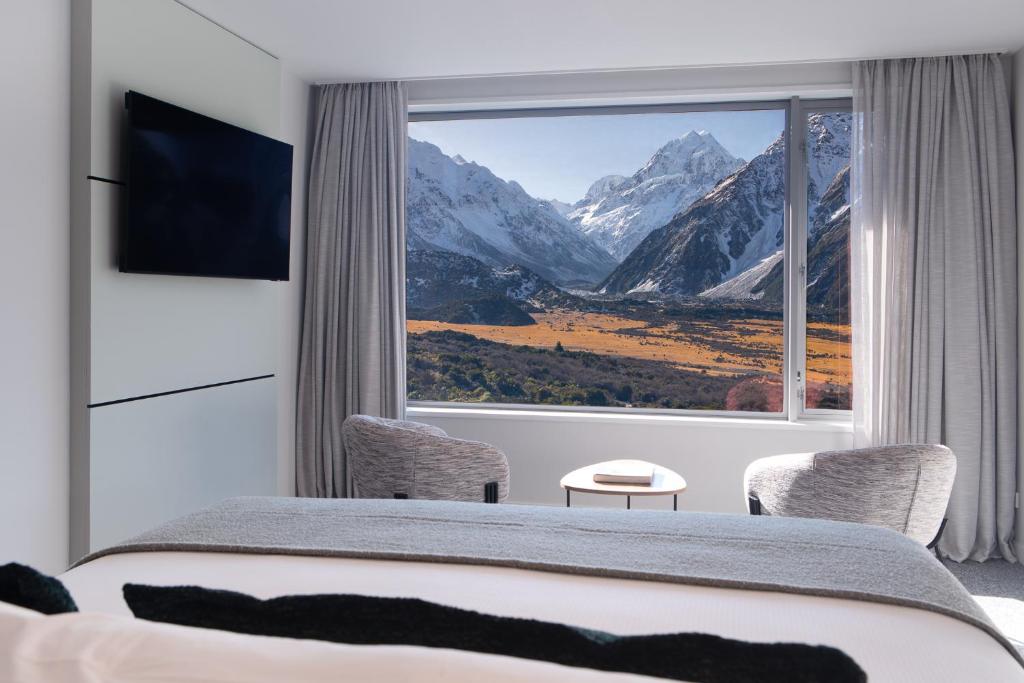
Accommodation inside the village is extremely limited. The Hermitage is the one I would book first and well ahead of time if you want the classic Mount Cook stay; waiting until a few weeks before a summer trip is gambling with very small room inventory.
ICONIC SPLURGE
The classic full-service stay in the village, with the kind of mountain setting that makes an early hiking alarm much less offensive. Rooms are limited and popular dates disappear early, so book this well ahead of time.
BEST ALL-ROUND
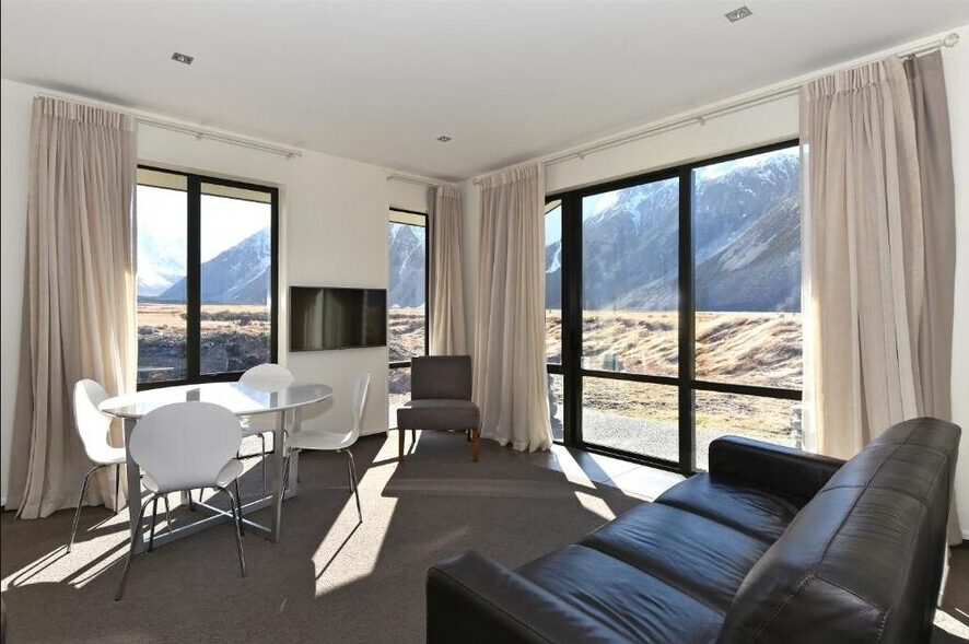
Modern, spacious units in the village with excellent mountain views and the practicality of motel-style accommodation. This is my first choice if you want more independence without giving up the Mount Cook location.
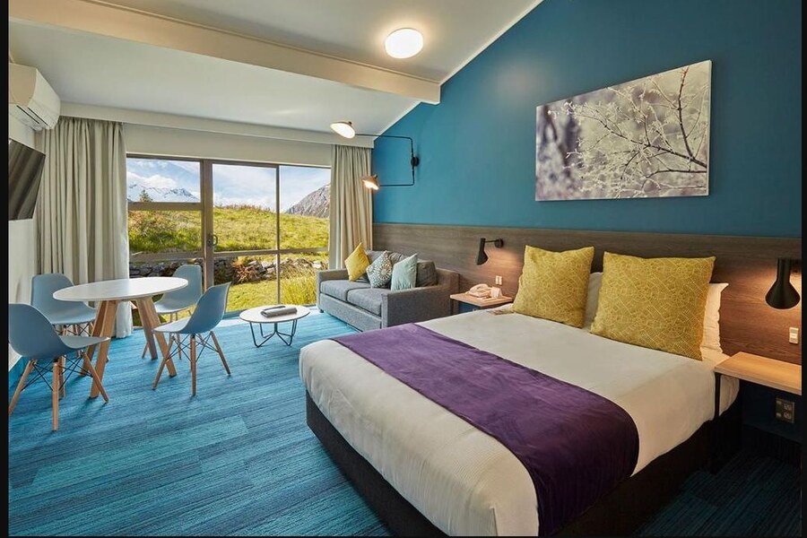
BEST VALUE WITH MORE COMFORT
A good middle ground if you want to stay inside Mount Cook Village without paying Hermitage prices. There are lodge rooms and motel-style options, plus Chamois Bar & Grill right on site for an easy dinner.
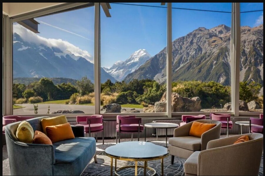
READ NEXT:
Where to Stay in Aoraki/Mount Cook
Compare Mount Cook Village, nearby bases and the best places to stay

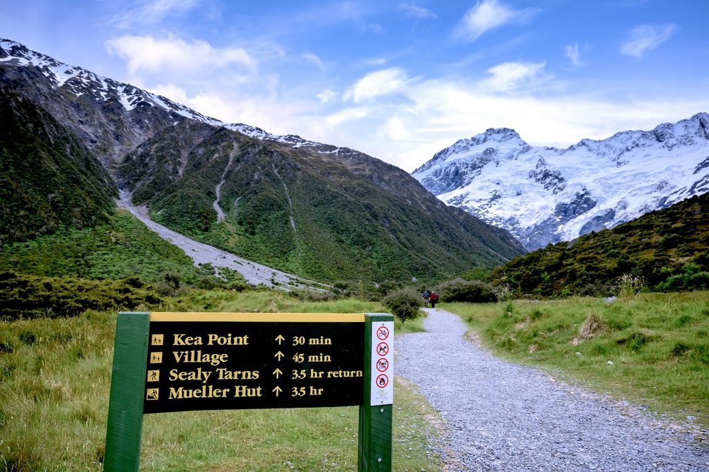
1. Kea Point Track
Distance: Approx. 3 km (1.9 mi) return from White Horse Hill
Time: About 1 hour return from White Horse Hill; about 2 hours from Mount Cook Village
Elevation: Gentle overall; up to about 180 m (591 ft) gain from the longer village start
Difficulty: Easy
Trailhead: White Horse Hill or near the Aoraki/Mount Cook Visitor Centre
Parking: White Horse Hill is paid
Best time: Sunset
Kea Point is the walk I recommend when you want a proper Mount Cook payoff without committing half a day. Calling it a hike is generous if you start at White Horse Hill, but the epicness of a viewpoint is thankfully not measured in suffering.
The track winds through subalpine grass and scrub toward the moraine wall above Mueller Glacier Lake. At the viewing deck you get a broad view over the lake, Mount Sefton, the Hooker Valley and Aoraki/Mount Cook in the distance.
I especially like Kea Point at sunset. The light on Aoraki and the Mueller moraine can be incredible, and it is short enough that you can squeeze it in after arriving in the village or after a longer daytime hike.
The name is not accidental either. Kea live in the area and you may hear their sharp call before you see them. They are alpine parrots, ridiculously intelligent and professionally interested in anything you left unattended. Do not feed them, and do not make your backpack the day’s enrichment toy by leaving food half-zipped inside.
2. Hooker Valley Track
Distance: 10 km (6.2 mi) return
Time: About 3 hours, longer if you stop constantly for photos which you will
Elevation: Mostly flat with gentle grades
Difficulty: Easy–moderate
Trailhead: White Horse Hill car park
Parking: Paid; NZ$2.50 per half hour or NZ$25/day
Best time: Early morning
If you are searching for the best hikes in Mount Cook, this is the obvious one. The Hooker Valley Track is popular for a reason: glaciers, moraine lakes, three suspension bridges, open alpine valley and Aoraki sitting ahead of you for much of the second half.
The full track reopened on July 28, 2026 after the second bridge was replaced. The new bridge is 189 m (620 ft) long and is now New Zealand’s longest suspension bridge. The route still follows the same basic out-and-back journey from White Horse Hill to Hooker Lake.
The first kilometer brings you past Freda’s Rock, the Alpine Memorial and Mueller Lookout before the first suspension bridge. From there the track crosses old glacial moraine toward the Mount Sefton viewpoint. The second-bridge area was always one of my favorite parts of this hike; the bridge itself is new now, but this stretch is still where the valley really opens up.


Beyond the second bridge, the track crosses tussock and boardwalks before the third suspension bridge and the final approach to Hooker Lake. On a clear day Aoraki dominates the view ahead, and in summer you may see icebergs scattered across the lake below the Hooker Glacier.
I absolutely loved this hike. I loved it enough to do it twice in two days. The first time, I dragged an inflatable paddleboard all the way out because paddling a glacial lake had been a dream of mine. The next morning I walked the whole thing again to avoid the crowds and get better photos.
I would not copy the paddleboard part now. DOC explicitly tells visitors to stay out of the glacial lakes because the water is typically around 3°C (37°F), hypothermia can happen quickly and icebergs are unstable. File that one under things I did, not things I am recommending you do.
For the actual hike, I still recommend an early start. You get quieter bridges and boardwalks, cleaner photography, easier parking and often calmer conditions before afternoon winds pick up. Even in summer, carry a waterproof layer. Weather can move through this valley ridiculously fast.
3. Sealy Tarns Track
Distance: 5.8 km (3.6 mi) return
Time: 3–4 hours return
Elevation gain: About 600 m (1,969 ft)
Difficulty: Strenuous
Trailhead: Branches off Kea Point Track
Parking: White Horse Hill is paid
Best time: Morning in summer; only in suitable conditions when snow or ice is present
Sealy Tarns is only a little more than half the distance of Hooker Valley, yet it can take longer because this one goes up. And up. And then up another staircase.
The track is nicknamed the Stairway to Heaven for its roughly 2,200 steps. It climbs about 600 m (1,969 ft) from the valley floor to the tarns, with increasingly ridiculous views over the Hooker Valley, Mueller Lake, Hooker Lake and the surrounding peaks as you gain height.
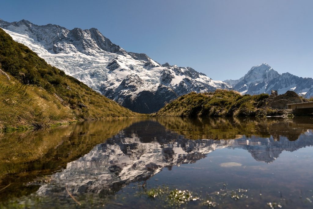
The tarns themselves are small alpine pools rather than some dramatic turquoise lake, so do not hike all this way because you are expecting a miniature Lake Pukaki. The reward is the panorama. On a still day you may also get reflections of Mount Sefton and the surrounding peaks in the water.
In summer, I prefer getting onto the stairs early before the sun turns the slope into a giant outdoor StairMaster. In colder months, timing matters less than actual conditions. Snow and ice can make the steep stepped track slippery, and this is not the place to let a sunny village forecast talk you into ignoring what is happening higher up.
4. Mueller Hut Route
Distance: About 10 km (6.2 mi) return
Time: About 4 hours up and 3 hours down
Elevation gain: About 1,000 m (3,281 ft)
Highest point: Mueller Hut sits at about 1,800 m (5,906 ft)
Difficulty: Advanced alpine route beyond Sealy Tarns
Trailhead: White Horse Hill via Sealy Tarns
Parking: Paid; overnight parking is charged for both days
Book ahead: Mueller Hut if staying overnight
Mueller Hut is the natural continuation of Sealy Tarns, but do not mentally file it as “a few more stairs.” Beyond the tarns, the maintained walking track ends and the route becomes a proper alpine trip marked by orange poles.
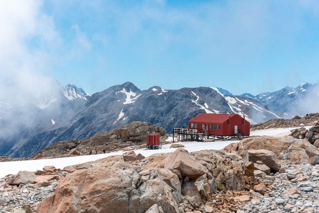
From Sealy Tarns you climb through tussock and rocky ground toward the ridgeline, then traverse toward the bright red Mueller Hut. The reward is a 360-degree alpine panorama of glaciers, ice cliffs and some of New Zealand’s highest peaks.
In normal summer conditions, fit hikers with solid tramping experience can complete the route as a long day. Staying overnight gives you more time and the chance to see sunset and sunrise from high above the valley, but the hut needs to be booked.
Outside straightforward summer conditions, the difficulty jumps quickly. Snow and ice can linger from March into November, avalanche terrain is involved, and winter can require an ice axe, crampons, avalanche rescue gear and the skills to use them. Sealy Tarns is the sensible decision point: if the weather, visibility or group confidence is wrong, stop there and enjoy the view you already earned.
5. Hooker Hut
Distance: Approx. 8 km (5 mi) return
Time: About 4 hours return
Elevation gain: 120 m (394 ft)
Difficulty: Tramping track; uneven and unformed beyond the Hooker Valley Track
Trailhead: White Horse Hill via the Hooker Valley Track
Parking: Paid at White Horse Hill
Book ahead: The eight-bunk hut if you want to stay overnight
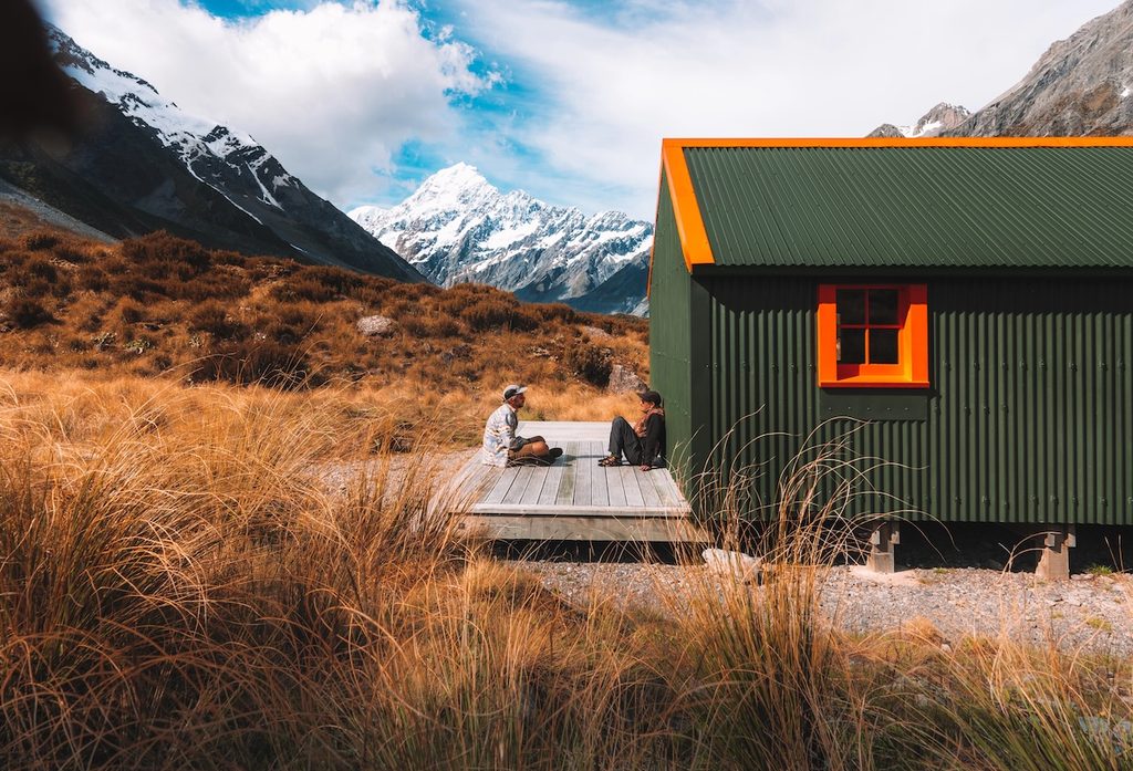
Hooker Hut is what I would choose if you like the Hooker Valley scenery but want to peel away from the main stream of walkers. It is the oldest hut in Aoraki/Mount Cook National Park, fully restored and now sitting below Mount Sefton with huge views back toward Aoraki.
You start on the Hooker Valley Track, then turn off shortly after the toilets at Stocking Stream. From there, the character changes completely. The formed tourist track disappears and you pick your way through tussock and alpine scrub, enter the stream bed and follow marker poles toward the hut.
This is not technically difficult in normal summer conditions, but it is not just a quieter extension of Hooker Valley. The final section is unformed, footing is uneven and you need to pay attention to the route. DOC classifies it as a tramping track rather than a walking track.
The hut itself has eight bunks, a gas cooker, fireplace and detached toilet. You can visit it as a day hike or stay overnight, which is a brilliant option if you want an accessible hut experience without committing to Mueller Hut’s 1,000 m (3,281 ft) climb.

6. Tasman Glacier View Track & Blue Lakes
Distance: About 1.5 km (0.9 mi) return to the glacier viewpoint; Blue Lakes adds a short side trip
Time: About 30–45 minutes plus photo stops
Elevation: About 100 m (328 ft) gain; short but steep, with 300+ steps
Difficulty: Easy–moderate
Trailhead: Tasman Valley car park
Parking: Free
Best time: Sunrise
The Tasman Valley sits on the other side of Mount Cook Village from Hooker Valley, and it deserves its own visit rather than being treated as a spare ten minutes on the drive out.
The Tasman Glacier View Track climbs more than 300 steps to the top of the moraine wall above Tasman Lake. It is short, but the climb is enough to wake your legs up. From the viewpoint you look along the lake toward Haupapa/Tasman Glacier, with Aoraki and the Southern Alps around the valley on a clear day.
The glacier has retreated dramatically and Tasman Lake is a relatively recent landscape, growing as the glacier melts. You are not standing beside some pristine blue wall of ice; the glacier is distant and partly debris-covered. The scale of the lake and moraine makes the change easier to understand than any infographic ever will.
On the way up you can detour to the first of the Blue Lakes. The name is now delightfully misleading: they are usually green because they are fed mainly by rainwater rather than glacial meltwater.
I like this area at sunrise. It is quieter, the light moves across the lake and icebergs, and you can be back in the village before breakfast without having sacrificed half your day.
7. Tasman Lake & River Track
Distance: 2.5 km (1.6 mi) return
Time: About 50 minutes return
Elevation: About 86 m (282 ft) of total elevation change
Difficulty: Easy
Trailhead: Tasman Valley car park
Parking: Free
Best for: Lake-edge views and anyone who would rather skip 300+ steps
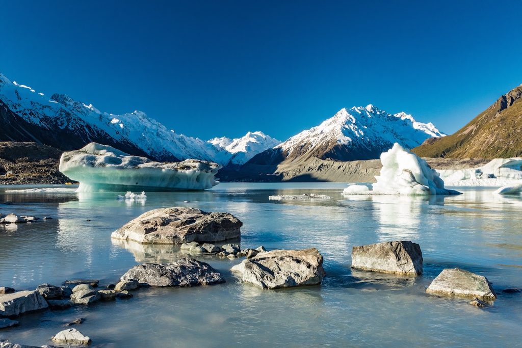
If the Tasman Glacier viewpoint is the overview, this is the closer look at the lake itself. The track heads toward the outlet where Tasman Lake becomes the Tasman River, giving you a different angle on the same glacial landscape.
It is also a good alternative if stairs are a problem. You lose the elevated panorama from the moraine wall, but you gain a lower perspective over the lake and a very easy walk that fits neatly beside the glacier viewpoint if you have 1.5–2 hours for Tasman Valley.
Do not wander onto unstable moraine or down to the water wherever you feel like it. Tasman Lake and its moraine walls have genuine hazards, and the glacier environment keeps changing.
8. Old Ball Hut Road & Ball Hut Track
Easy-to-follow section: First 5 km (3.1 mi) one way along the historic road/4WD track
Time: Allow about 3–4 hours return if you turn around near the end of the 4WD section
Difficulty: Straightforward valley walking at first; advanced beyond Husky Flat
Trailhead: Tasman Valley / Blue Lakes car park
Parking: Free
Best for: A quieter, more remote-feeling side of the Tasman Valley
This is the walk that made me realize how misleading the word “village” can be when people talk about hiking in Mount Cook. Aoraki/Mount Cook National Park is enormous, and the old Ball Hut Road takes you much farther into the Tasman Valley than the short glacier-view tracks.
I actually first saw this part of the valley from a 4WD. We drove along the old road beside the enormous Tasman Glacier moraine, and I remember being surprised by how many people were hiking the same route. It felt completely different from the polished Hooker Valley Track: wider, emptier and much more obviously shaped by the retreating glacier.
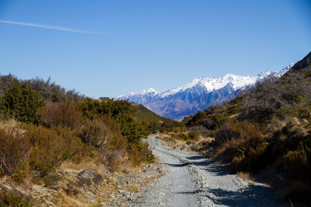
The first 5 km (3.1 mi) of the Ball Hut Track follows that historic road, which is now a 4WD track. This is the section I would recommend to most experienced day hikers as an out-and-back. You get long views up the Tasman Valley, the lateral moraine running beside you and far fewer people than on Hooker Valley.
Do not assume the full Ball Hut Track is simply more of the same. A severe weather event in 2019 created an impassable gorge at Husky Flat. Beyond that point there is no marked bypass, the moraine is unstable and DOC recommends high-level tramping and navigation skills. The Ball Road is also complex avalanche terrain, with large avalanches regularly crossing it in winter and spring.
If your goal is simply to experience this side of the park, walk the old 4WD-road section and turn around before the route becomes serious. If you specifically want Ball Hut, check current conditions at the Aoraki/Mount Cook Visitor Centre and treat it as a backcountry route rather than a normal tourist hike.
9. Red Tarns Track
Distance: Approx. 4 km (2.5 mi) return
Time: About 2 hours return
Elevation gain: 300 m (984 ft)
Difficulty: Moderate and steep
Trailhead: Public shelter on Bowen Drive in Mount Cook Village
Parking: Start in the village; no need to use White Horse Hill
Best time: Summer sunset
Red Tarns gets much less attention than Hooker Valley and Sealy Tarns, but it fills a useful gap: you get a proper steep climb and a high viewpoint without driving to White Horse Hill or committing four hours.
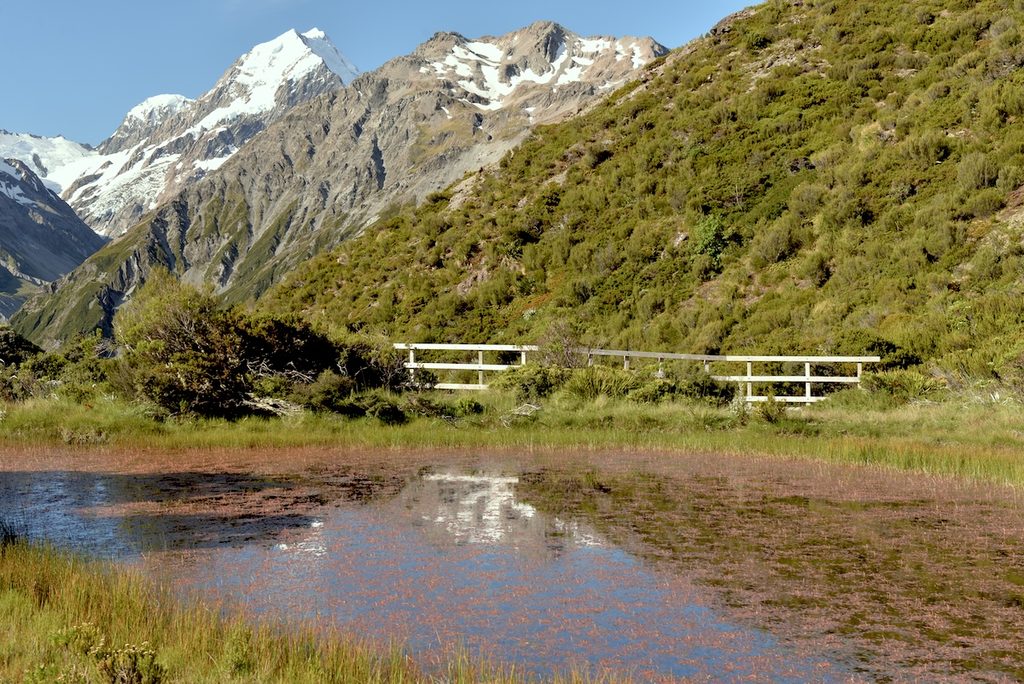
The track starts by the public shelter, crosses Black Birch Stream and then climbs hard through changing vegetation toward the tarns. At the top, a bench looks across the village and valley toward Aoraki/Mount Cook.
The tarns are named for the red pond weed growing in them, but again, hike for the panorama rather than the puddles. In summer this is a particularly good sunset option if Kea Point feels too easy and Sealy Tarns is more commitment than you want late in the day.
10. Governors Bush & Glencoe Walk
Governors Bush: About 1.5 km (0.9 mi) loop, 1 hour, 100 m (328 ft) gain
Glencoe Walk: About 0.5 km (0.3 mi) return, 30 minutes, around 40 m (131 ft) gain
Difficulty: Easy
Trailheads: Mount Cook Village; Glencoe starts behind The Hermitage
Best for: Bad weather, tired legs or an easy walk before leaving
I would not travel to Mount Cook specifically for either of these, but these short walks can neetly fill any dead time.
- Governors Bush loops through one of the few stands of silver beech forest in the park and is more sheltered than the exposed valley tracks.
- Glencoe climbs through forest behind The Hermitage to a viewpoint over the village and toward the Hooker Valley.
They are exactly the kind of walks that save a day when the high tracks are sitting under ugly cloud and wind. Mount Cook weather does not care that you color-coded an itinerary.
Which Mount Cook hike should you choose?
| If you want… | Choose… |
|---|---|
| The classic Mount Cook experience | Hooker Valley Track |
| A huge view in under an hour | Kea Point or Tasman Glacier View |
| The best sunset | Kea Point for easy; Red Tarns for a workout |
| The best sunrise | Tasman Glacier View |
| A hard hike without committing to a full alpine route | Sealy Tarns |
| A serious alpine day | Mueller Hut Route in suitable conditions |
| A quieter historic hut | Hooker Hut |
| A long, quieter Tasman Valley walk | Old Ball Hut Road to the end of the 4WD section |
| An easy poor-weather option | Governors Bush |
| No stairs in Tasman Valley | Tasman Lake & River Track |
Hiking Mount Cook in winter
You can absolutely visit Aoraki/Mount Cook in winter, but “the track is open” and “the track is sensible for me today” are not the same statement.
Hooker Valley, Kea Point and the village walks can all become icy. Microspikes and hiking poles are useful on frozen sections, and snow can close State Highway 80 entirely. Sealy Tarns, Mueller Hut, Hooker Hut and Ball Hut Road move into much more serious terrain as snow builds.
The majority of Aoraki/Mount Cook National Park is avalanche country. Ball Hut Road is classed as complex avalanche terrain and large avalanches regularly cross it in winter and spring. The route from Sealy Tarns to Mueller Hut is also serious avalanche terrain, while Hooker Hut sits beyond the maintained walking-track network.
Check the current track status, road conditions, weather and avalanche forecast on the day. If you arrive to cloud sitting on the ridges or a poor avalanche forecast, swap the ambitious plan for Hooker Valley, Kea Point, Tasman Lake or a village walk instead of trying to win an argument with the Southern Alps.

Beyond the main Mount Cook hikes
The trails above cover the walks and tramps I think are most useful for normal hiking itineraries, but they barely scratch the surface of the national park. Beyond the Hooker and Tasman Valley day walks, Aoraki/Mount Cook becomes proper alpine country very quickly.
- Full Ball Hut Track: continuing beyond Husky Flat requires good navigation and high-level tramping skills because the old road has been broken by an impassable gorge and unstable moraine. Ball Hut itself is a tiny three-bunk backcountry hut overlooking the Tasman Glacier.
- Ball Pass Crossing: a 2–3 day alpine crossing between the Tasman and Hooker sides of the park. This involves exposed terrain, route finding and mountaineering skills rather than normal marked-track hiking.
- Sefton Bivouac: a spectacular historic biv at about 1,650 m (5,413 ft) beneath The Footstool. The route is unmarked, steep and exposed, with real consequences if you get it wrong. It belongs in a mountaineering plan, not a spontaneous extension after Hooker Valley.
- Ball Ridge and Caroline Hut: guided alpine treks use the old Ball Hut Road for 4WD access before climbing onto Ball Ridge toward Caroline Hut. This is the terrain you see rising above the Tasman Glacier moraine, but the climb itself is rough, untracked alpine travel rather than another national-park walking track.
For any of these routes, use current DOC information, avalanche forecasts and advice from the visitor centre. Conditions matter more than whatever timetable you arrived with.

Mount Cook from a different perspective
I would hike first. The scale of this place makes more sense after you have actually walked through one of the valleys. But if your budget allows it, seeing Aoraki, the glaciers and the Southern Alps from the air is on another level.
Mount Cook experiences I would shortlist:
45-minute Glacier Highlights helicopter flight
The simplest big aerial splurge: enough time to appreciate the Southern Alps properly without losing half the day.Ski-plane and helicopter glacier combo
My pick if you want something more unusual than a standard helicopter flight and want two different types of aircraft in one experience.Tasman Glacier heli-hike
The proper bucket-list option if walking on the glacier matters more to you than simply flying over it.Mount Cook stargazing experience
A good evening add-on if your legs are done but you are not ready to waste the dark-sky setting by going to bed at 9.
Flights and heli-hikes are weather-dependent. If one of these is a major reason for your trip, stay at least one night and give yourself a backup window rather than booking a flight two hours before you are supposed to leave the national park.

Mount Cook hiking FAQ
What is the best hike in Mount Cook?
The Hooker Valley Track is the best all-round hike for a first visit. It gives you the classic valley scenery, suspension bridges, glacier lakes and close views toward Aoraki without a huge elevation gain.
What is the easiest Mount Cook walk with a big view?
Kea Point is my pick if you are already at White Horse Hill. The Tasman Glacier View Track is even shorter in time but includes more than 300 steps. Governors Bush and Glencoe are easier if you mainly want a gentle walk rather than the biggest panorama.
How many days do you need for Mount Cook hikes?
One full day is enough for Hooker Valley plus one short walk. Two days is much better because it gives you a weather buffer and lets you combine Hooker Valley with Sealy Tarns or the Tasman Valley without rushing. If you want Mueller Hut, I would build the trip around that hike and keep another window free in case conditions are poor.
Do you need to pay to hike at Mount Cook?
The walking tracks themselves are free. The main extra cost is parking at White Horse Hill, currently NZ$2.50 per half hour or NZ$25 for a full day. Tasman Valley parking is free. Huts, campsites and guided experiences are separate.
Can you hike Hooker Valley in winter?
Yes in suitable conditions, but the track can be icy and extremely slippery. Carry winter traction when needed, check the track and road status, and do not assume a clear forecast in Twizel means the valley is easy.
Planning a hiking trip to Aoraki/Mount Cook?
If hiking is one of the main reasons you are coming, give Mount Cook at least one full day and preferably two nights. One night lets you arrive in the afternoon, use the evening for Kea Point or Red Tarns, start Hooker Valley early the next morning and still squeeze in Tasman Valley before leaving. Two nights gives you the weather buffer this place deserves.
Stay in Mount Cook Village if you can afford it, especially if you want sunrise or sunset hikes. The Hermitage is the iconic option, but it needs booking well ahead. Aoraki Court Motel is my practical all-round pick, while Haka House Aoraki Mt Cook is the first place I would check for better value inside the village.
If you are driving, stock up before turning onto State Highway 80. Mount Cook Village has very limited shopping and eating options, and weather can change your plans quickly. I would arrive with hiking snacks, breakfast food, a proper waterproof layer and enough flexibility that a cloudy morning does not ruin the whole stop.
If you do not want to drive, there are now proper day-tour options. From Queenstown, I would choose this Mount Cook and Hooker Valley small-group tour. From Christchurch, this Mount Cook, Lake Tekapo and Tasman Glacier day tour covers the long drive without making you do the long drive.
Read next:
Christchurch & Canterbury:
Christchurch itinerary: 1, 2, 3, 5 or 7 days
Where to stay in Christchurch
Best day trips from Christchurch
Christchurch to Queenstown road trip
Wānaka:
Wānaka itinerary: 1, 2, 3 or 5 days
Where to stay in Wānaka
West Coast & Glacier Country:
West Coast New Zealand road trip guide
Where to stay on the West Coast
Franz Josef Glacier heli-hike
Where to stay in Franz Josef
Queenstown & Glenorchy:
Queenstown itinerary: 3, 4, 5 or 7 days
Where to stay in Queenstown
Best day trips from Queenstown
Queenstown to Glenorchy scenic drive
Best things to do in Glenorchy
Milford Sound & Fiordland:
Complete Milford Sound guide
Where to stay in Milford Sound
Milford Sound from Queenstown
Te Anau to Milford Sound scenic drive
Where to stay in Te Anau
South Island road trips:
10-day South Island itinerary
2- and 3-week South Island road trip
Renting a car in New Zealand
Traveling New Zealand by campervan
Travel Insurance for New Zealand
New Zealand’s ACC scheme is not a replacement for comprehensive travel insurance. ACC may contribute toward treatment for an accidental injury in New Zealand, including for international visitors, but it does not cover ordinary illness, trip cancellation, disrupted flights, lost luggage, repatriation or every cost connected with an accident.
This matters particularly in Aoraki/Mount Cook because hiking, overnight huts, remote alpine terrain, helicopter flights and heli-hiking may have specific exclusions, altitude limits or rescue conditions buried in the policy wording. If you plan to do Mueller Hut, Hooker Hut, Ball Hut, a heli-hike or anything beyond the easy walking tracks, check the activity wording rather than assuming “hiking” automatically means every hike.
I always arrange insurance before leaving, and Travel Insurance Masters is my go-to platform for comparing suitable policies for a specific trip.
Compare travel-insurance quotes and provider recommendations here.

AHHH, Girl these photos are amazing and you’re making me feel some type of way lol! I went to NZ in Sept for 2 weeks with my husband and it was the most magical experience ever! The weather wasn’t the best and I felt like didn’t get the whole experience, but I definitely need to go back! Great read! We started one trail, but it was raining and very windy haha!
Thank you Amanda!! Haha yes, the weather in New Zealand can be quite unpleasant. But the scenery more than makes up for it in our opinion :). At least you got a taste of New Zealand in those 2 weeks. There is soooo much to see, we spent more than a year travelling around and still haven’t seen everything we wanted to see!
Beautiful photos! I’ve always wanted to visit New Zealand!
Thank you so much Mary! New Zealand is absolutely gorgeous. If you get the chance to visit New Zealand, we’re certain you won’t regret it!
OK… so this is beautiful 🙂
Thank you cass, glad you like it! 🙂